| dc.contributor.author | Vindenes, Håvard | eng |
| dc.date.accessioned | 2015-08-14T11:50:46Z | |
| dc.date.available | 2015-08-14T11:50:46Z | |
| dc.date.issued | 2015-06-01 | |
| dc.date.submitted | 2015-06-01 | eng |
| dc.identifier.uri | https://hdl.handle.net/1956/10275 | |
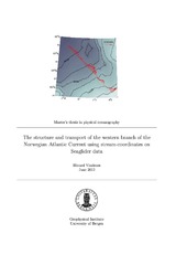
| dc.description.abstract | Data from 8 Seaglider transects, obtained along the Svinøy section in the Norwegian Sea during a 7-month period between May and December of 2012, have been used to test the applicability of stream-coordinate averaging on the Norwegian Atlantic Front Current, an unstable, meandering, baroclinic frontal jet. Additionally, we have estimated the transport of Atlantic Water in the western branch of the Norwegian Atlantic Current from absolute geostrophic velocity estimates. The Seaglider is an unmanned underwater vehicle, capable of dives down to a depth of 1000 m. It collects hydrographic data, and estimates a depth-averaged current for each dive which allows for an estimate of absolute geostrophic velocity and thus the geostrophic velocity at maximum dive depth. The stream-coordinate average of the Norwegian Atlantic Front Current is narrower and stronger than the corresponding Eularian average, with a current core 40 km wide and with maximum speed exceeding 30 cm/s, bearing a stronger resemblance to the current core observed in individual transects. The Eularian average, in contrast, results in a current more than 80 km wide with a maximum speed of approximately 18 cm/s. Transport estimates from the western branch of the Norwegian Atlantic Current are sparse relative to the eastern branch, and previous estimates based on dynamic calculations from hydrography have been reliant on an assumption of no motion at mid-depth. Our transport estimates of Atlantic water (defined as water with salinity greater than 35) in the western branch of the Norwegian Atlantic Current show an average value of 4.7 Sv (1 Sv = 10^6 m^3/s). The average contribution of the barotropic component of the transport is 2.6 Sv, which is equal to 54 % of the total transport. A comparison between the estimated current at 1000 m depth, derived from the Seaglider data, and measurements from a moored current-meter has been made in order to verify the validity of our current- and transport estimates. | en_US |
| dc.format.extent | 11758731 bytes | eng |
| dc.format.mimetype | application/pdf | eng |
| dc.language.iso | eng | eng |
| dc.publisher | The University of Bergen | en_US |
| dc.rights | Copyright the Author. All rights reserved | eng |
| dc.subject | Seaglider | eng |
| dc.title | The structure and transport of the western branch of the Norwegian Atlantic Current using stream-coordinates on Seaglider data | en_US |
| dc.type | Master thesis | |
| dc.description.degree | Master i Meteorologi og oseanografi | en_US |
| dc.description.localcode | MAMN-GEOF | |
| dc.description.localcode | GEOF399 | |
| dc.subject.realfagstermer | http://data.ub.uio.no/realfagstermer/c001600 | |
| dc.subject.realfagstermer | http://data.ub.uio.no/realfagstermer/c016681 | |
| dc.subject.realfagstermer | http://data.ub.uio.no/realfagstermer/c021765 | |
| dc.subject.nus | 756213 | eng |
| fs.subjectcode | GEOF399 | |
